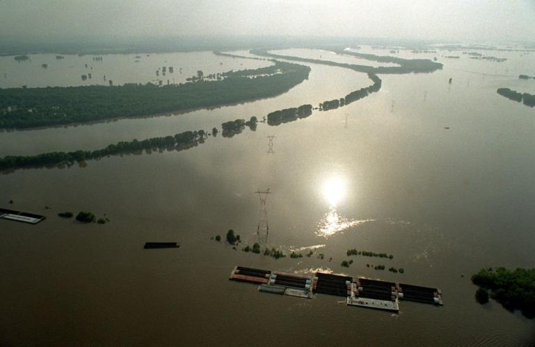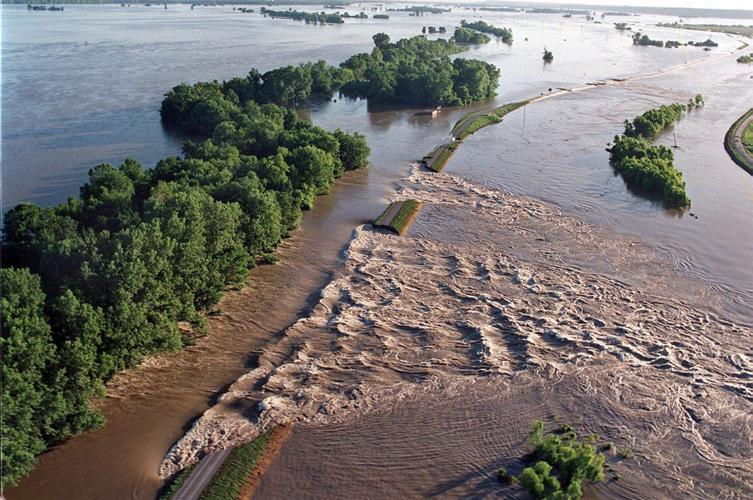

The surging Mississippi River burst levees and threatened a record crest. Sandbaggers, many of them students excused from class, sweated gallantly.
The river made history, running 13.2 feet over flood stage downtown. The flood swamped parts of St. Louis city and county and swept across the wide St. Charles County bottomland.
“Who ever thought it would get this far?” asked Alice Rothermich, whose home near Old Town St. Peters was usually four miles from the Mississippi. Seven inches of water covered her living-room floor.
She and her husband, Gerald, made repairs and stayed. People talked about the “great flood” of April 1973.
How little any of us understood the river’s power.
Only two decades later, the Mississippi roared back 6.3 feet higher — a staggering flow that stayed above flood stage for five months. The flood of 1993 covered 17,000 square miles across the Midwest. It forced 95,000 people to seek assistance, damaged or ruined 55,000 buildings and overwhelmed two-thirds of the levees along the upper Mississippi and Missouri rivers. The Missouri flowed from bluff to bluff.
People are also reading…
The new Great Flood caused or inspired permanent change to the landscape. In Missouri and Illinois, government agencies bought more than 7,700 ruined properties, including the Rothermich’s home. Two whole towns — Rhineland, Mo., and Valmeyer, Ill. — abandoned the lowland for good and rebuilt atop nearby bluffs.
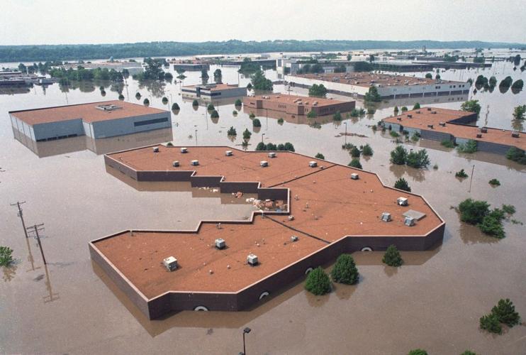
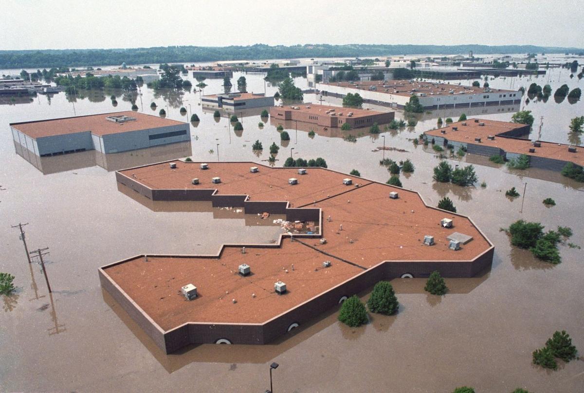
Other cities, including Ste. Genevieve and Chesterfield, responded with higher levees. Both were scenes of high drama during that long summer. In Ste. Genevieve, thousands of volunteers drawn worldwide by its colonial charm helped the National Guard save the city. In Chesterfield, a levee break on July 30 flooded miles of commercial development in the old Gumbo Flats along Highway 40.
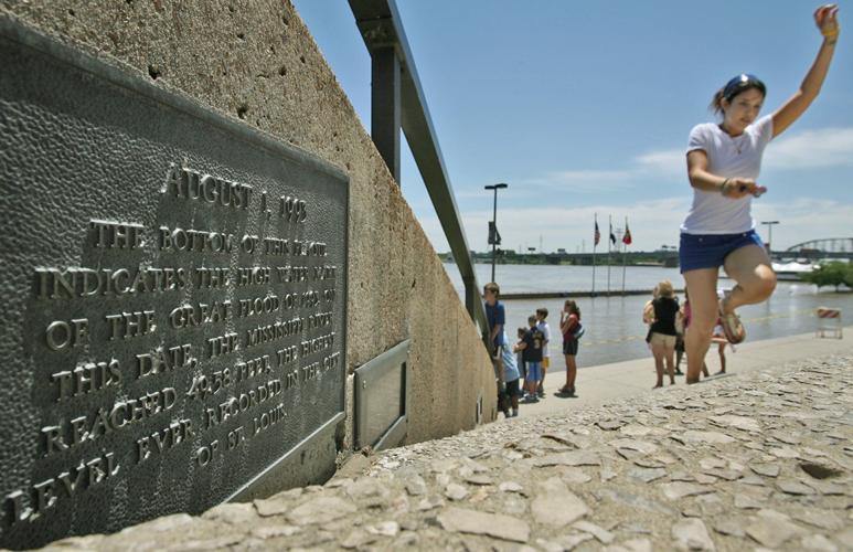
The crest on Aug. 1, 1993, was 19.6 feet over flood stage at St. Louis and halfway up the grand riverfront staircase at the Gateway Arch. Later "major" flooding, defined as 10 or more feet above flood stage, made less news in 1995 and 2013 because so many vulnerable residences.
The Great Flood began with a soggy autumn in 1992, followed by a wet spring. Through the summer, storms dumped two feet of rain and more across parts of five states.
All of that water had to flow beneath the Eads Bridge. On July 3, the Mississippi broke through a levee near Winfield, Mo., and, four days later, one near West Alton. Water backing up the River Des Peres swamped part of Lemay on July 9.
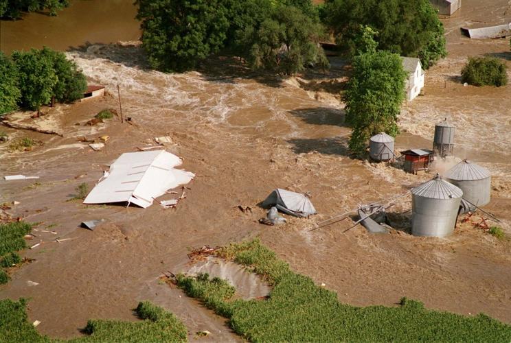
It just got worse. The rivers chased the residents of mobile-home parks near St. Charles, numerous farm communities, even the hardiest river rats in Grafton. It beat the 1973 record on July 15 and kept rising. On the morning of the crest, the Mississippi burst through a levee near Columbia, Ill., ripping apart the 86-year-old farmhouse of Virgil and Darleen Gummersheimer — a gripping image of the disaster.
All told, the river stayed above flood stage at St. Louis for 147 days. Cleanup and repairs took months. Government property buyouts in Missouri and Illinois cost $155 million, just one small line item on a nine-state, $12 billion flood bill.
Hydrologists eventually estimated the flood was a 330-year event.
That’s not as comforting as it sounds. It means one chance in 330 in any given year.
A look back at the Flood of 1993

When the Mississippi River reached record levels 33 years ago, the overflowing water covered 400,000 square miles and caused dozens of deaths.

Chesterfield Valley flooded on Aug. 1, 1993, after the Missouri River burst through the Monarch levee.

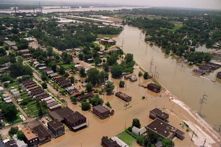
Streets near the River Des Peres in St. Louis were flooded on July 19, 1993. As crest predictions rose throughout the summer, brigades of volu…

In the St. Charles and West Alton areas, waters reached farmers, towns and flooded trailer parks. The floods had a lasting impact on the flood…

Flooded farms near Valmeyer are part of about 70,000 acres of cropland under water in Monroe County. The Illinois town had battled the flood 2…
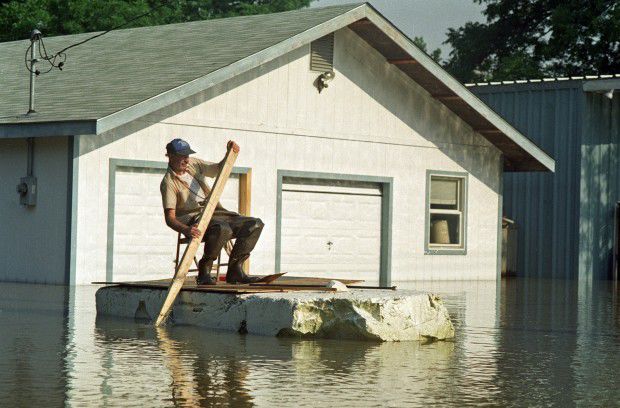
By mid-July, 1993, waters flooded every street in the town of Portage des Sioux and flooded downtown Alton. Most residents had Portage des Sio…
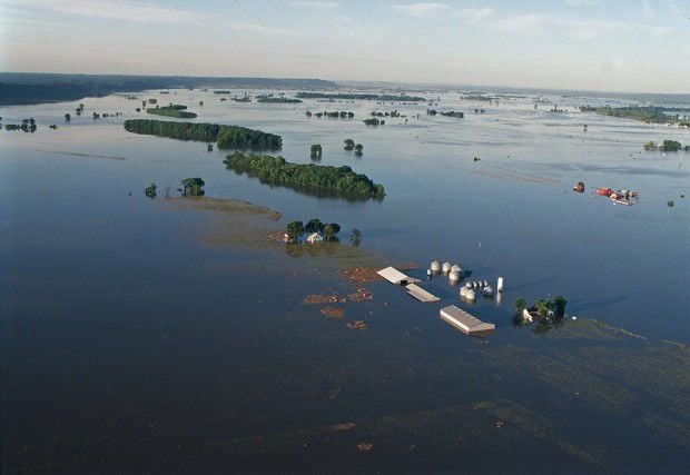
Flood waters, rain and bursting levees along the Missouri and Mississippi rivers created an ocean out of farmland.

Animal rescues were common during the flood. Some were dramatic as livestock and pets clung to roofs and fences. And, other times it was the p…

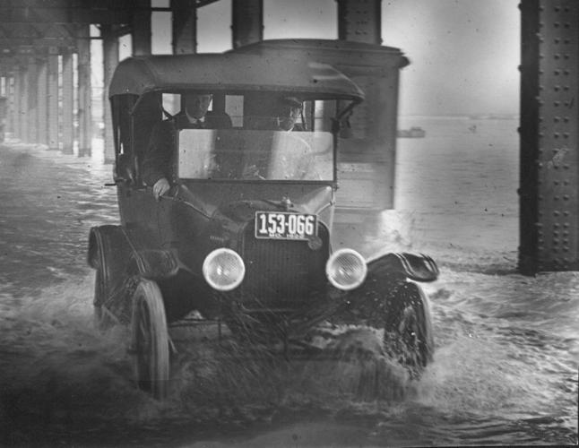
A car slowly sloshes through flood water on April 14, 1922, beneath the railroad trestle that once ran along Wharf Street along the downtown riverfront. On that day, the Mississippi River was 2.5 feet over flood stage. The trestle was demolished in 1961 to make way for construction of the Gateway Arch and park. Post-Dispatch file photo

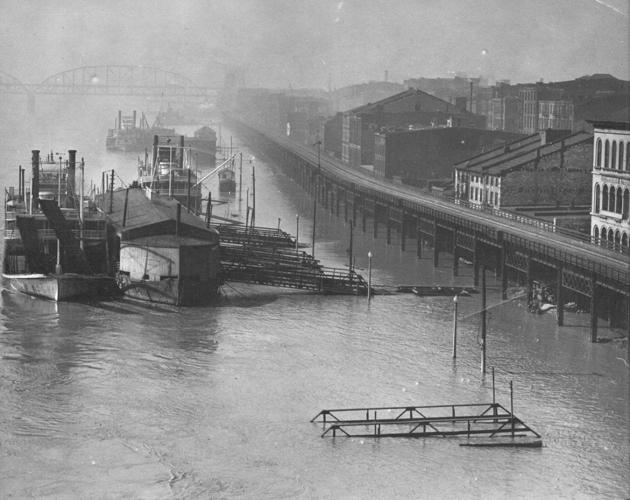
A scene on the downtown riverfront during a Mississippi River flood in on April 27, 1929. On that day, the river was 4.4 feet over flood stage. Scenes such as this have been common throughout the history of St. Louis, which was founded on the bluff beneath the present-day Gateway Arch to avoid flooding. But commerce had to meet the river, making floods a hazard of doing business. Post-Dispatch file photo

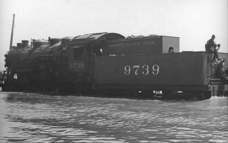
A Missouri Pacific Railroad locomotive chugs slowly through flood water on the track that once ran along Wharf Street, now known as Leonor K. Sullivan Boulevard. The scene is from April 29, 1929, when the river was 3.8 feet over flood stage. The tracks were paved over in 1982. Work is underway to raise the riverfront street three feet, which will get it above most of the floods that periodically wash over it. Post-Dispatch file photo

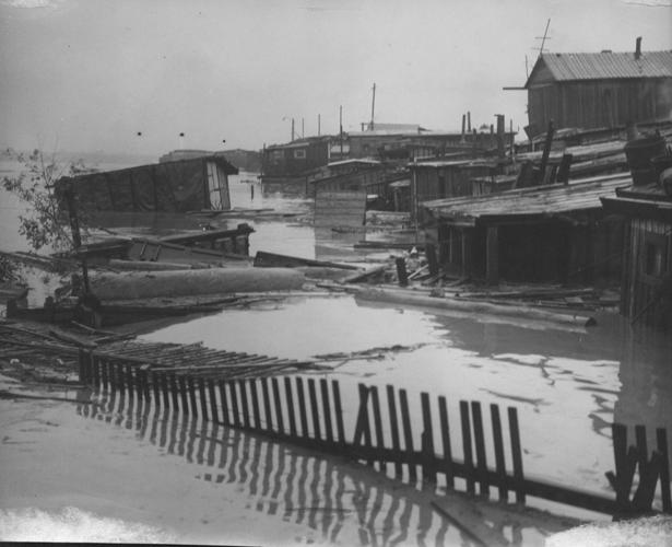
A scene of damage to St. Louis' Hooverville caused by the rising Mississippi River in May 1933. The community of shacks was built by homeless families along the riverbank just south of the Municipal (MacArthur) Bridge during the early days of the Great Depression. The river never reached flood stage that month. These shacks had been built too close to the river. Post-Dispatch file photo

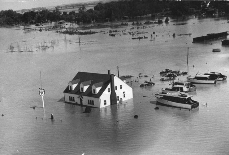
Boat owners tied up near this flooded gasoline station in St. Charles County near Portage des Sioux during a flood in late June 1942. Post-Dispatch file photo

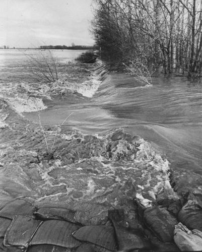
The rising Missouri River breaks through a levee in St. Charles County east of the Missouri 367 bridge on March 29, 1973. Photo by Renyold Ferguson of the Post-Dispatch

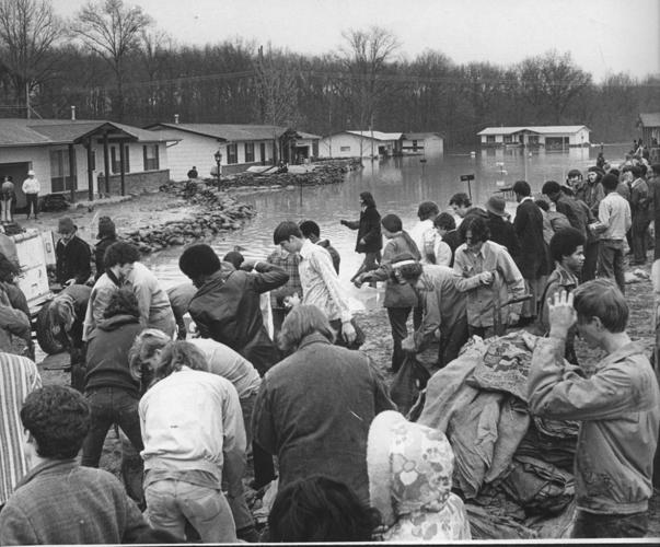
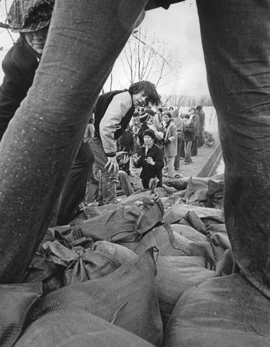
Students from St. Mary's and Hancock high schools work a sandbag line near Fannie Avenue in Lemay on March 29, 1973. Flood water from the rising Mississippi River backed into the River Des Peres and flooded parts of Lemay and Carondelet. On March 30, the Mississippi was 7.6 over flood stage downtown, and would rise another 5.6 feet on April 28 to a record crest. That record would hold until the flood of 1993. Photo by Jack January of the Post-Dispatch

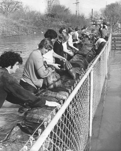
Sandbaggers work on April 3, 1973, to protect homes along Tesson Court in St. Louis near the River Des Peres, which was swollen with flood water backing up from the nearby Mississippi River. On this day the river was 9.4 feet over flood stage downtown, heading toward a crest 12.2 feet over flood on April 28. That would be the record flood height here until the flood of 1993, which ran nearly 6.2 feet higher. Photo by Jack January of the Post-Dispatch

Students from Lindenwood College (now university) and nearby high schools load sandbags onto a barge near Winfield on April 3, 1973, to patch endangered spots on the levees along the flooding Mississippi River. Hundreds of students were excused from classes to help fight the flood of 1973. Photo by Renyold Ferguson of the Post-Dispatch

A dog looks out the window of a flooded home near Arnold on April 28, 1973, when the flooding Mississippi River crested. The home is near the Meramec River, which spilled over its banks because of water backing up from the Mississippi. Photo by Lester Linck of the Post-Dispatch
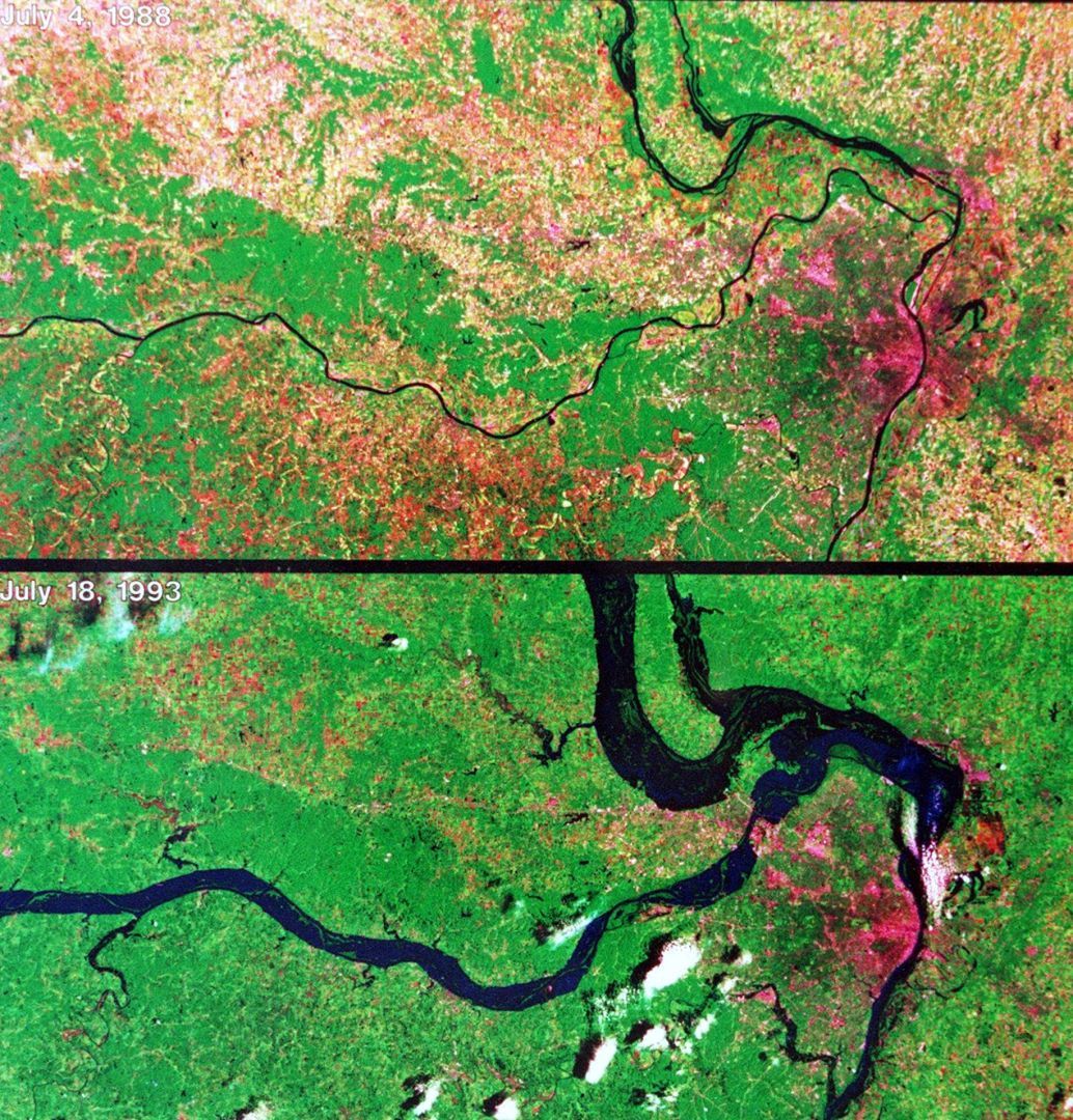
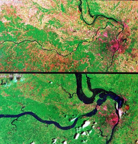
Two LandSat satellite images show the extent of flooding along the Missouri and Mississippi rivers by July 18, 1993, when the record flood that year hadn't even reached its crest. The top image is of the two rivers during normal flow. The lower one shows flooded land along both rivers. On that day, the river already was 16.5 feet over flood stage, with 3.1 more to go to reach 49.6 feet on Aug. 1, 1993. That is the record at St. Louis, where flood stage is 30 feet. Post-Dispatch file photo

Kim and Jeanna Gillman walk along the Burlington Northern line in St. Charles County to leave their flood-threatened home in West Alton on July 8, 1993, one day after a Mississippi River levee broke nearby. The surging Mississippi and Missouri rivers would cover the county's wide bottomlands during the record flood of 1993. Photo by Larry Williams of the Post-Dispatch

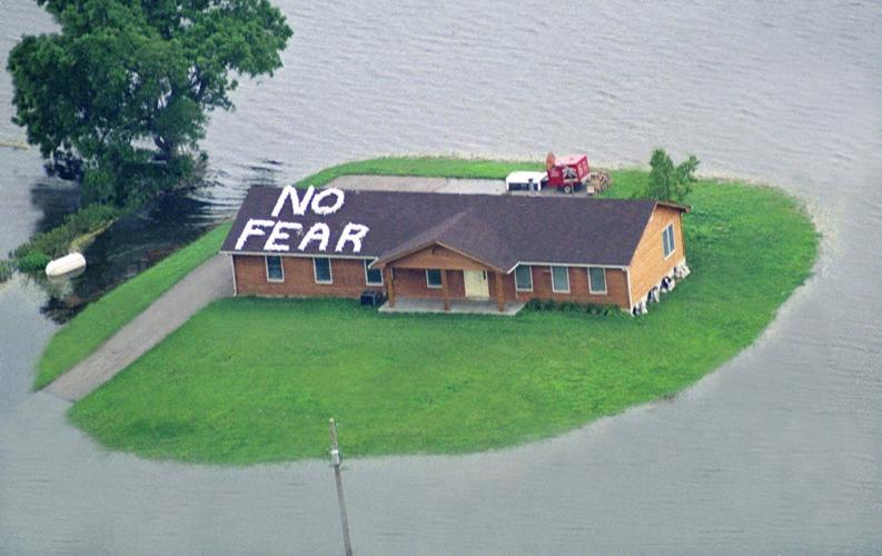
Martin Sontheimer posted this message with sandbags on the roof of his St. Charles County home during the flood of 1993. The photograph, taken July 13, ran in newspapers worldwide. The house survived the flood. Photo by Sam Leone of the Post-Dispatch

Volunteers fill sandbags at a bag-making station near the River Des Peres on July 16, 1993, two weeks before the Mississippi River reached its record flood crest. Water backed up the River Des Peres and into some neighborhoods, but sandbaggers kept the water from getting into homes west of Interstate 55. Thousands of people assisted in floodfighting all along the Mississippi and Missouri rivers and their swollen tributaries. Photo by Wayne Crosslin of the Post-Dispatch

Water that backed up the River Des Peres from the surging Mississippi River broke the sandbag defenses on July 18, 1993, and flooded part of the Carondelet neighborhood. The flooded street in the foreground is Alabama Avenue, which becomes Lemay Ferry Road across the submerged river bridge. Photo by Jerry Naunhiem Jr. of the Post-Dispatch

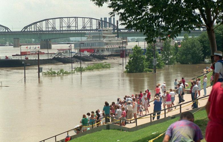
Sightseers gather on the grand staircase near the Gateway Arch to watch the flooding Mississippi River on July 19, 1993. On Aug. 1, 1993, the day the flood crested, the river rose exactly halfway up the 64 stairs, three feet higher than pictured. The prolonged and historic flood made headlines worldwide. File photo by J.B. Forbes

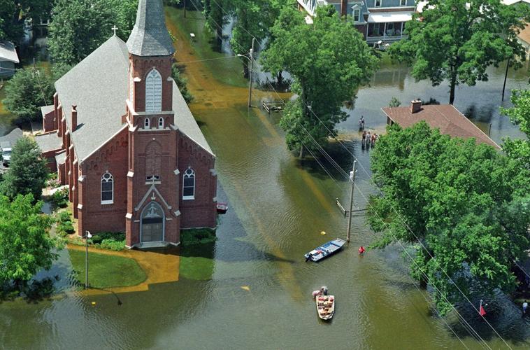
Residents of Portage des Sioux move household goods by boat from their flooded town and past St. Francis of Assisi Catholic Church on July 19, 1993, when the historic flood was within two feet of its crest. The Mississippi River flooded the low-lying town and its church, but some residents stayed put. Photo by Jerry Naunheim Jr. of the Post-Dispatch

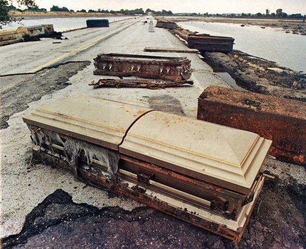
Some of the caskets that were scoured from a cemetery at Hardin, in western Missouri, by the Missouri River during its crest in late July 1993. Receding water revealed the caskets. Some never were recovered. Photo by Jerry Naunheim Jr. of the Post-Dispatch

Sandbaggers work through the night of July 31, 1993, in St. Louis. The Mississippi nearly overwhelmed this line the next morning, but a massive break of a levee near Columbia, Ill., dropped water levels upstream in St. Louis. Photo by Larry Williams of the Post-Dispatch

The confluence of the Mississippi and Missouri rivers on Aug. 1, 1993, the crest of the historic flood. Photo by Odell Mitchell Jr. of the Post-Dispatch

The Mississippi River breaks through a levee near Columbia, Ill., on the morning of Aug. 1, 1993, and destroys the farm of Virgil and Darleen Gummersheimer. The river crested that day at St. Louis 19.6 feet over flood stage, the record. Water flooding across the bottomland near Columbia swamped the town of Valmeyer 11 miles south. Photo by Jim Rackwitz of the Post-Dispatch

Water from the rampaging Mississippi River breaks through the Fountain Creek levee protecting Valmeyer, Ill., on Aug. 2, 1993. The flood overwhelmed the town, which was rebuilt on high ground beyond the bluff. Photo by Scott Dine of the Post-Dispatch

Children play on the main riverfront staircase to the Gateway Arch in 2008. The plaque in the foreground marks the high water on Aug. 1, 1993, when the Mississippi River rose halfway up the 64-step staircase to its historic crest. Photo by J.B. Forbes of the Post-Dispatch